Sunday, May 30, 2010

Hoh, Hoh, Hoh!

We left Aberdeen in the drizzling rain heading north on 101 towards Amanda Park. We were immediately struck by the lack of vehicles on the road especially since it is a long weekend.

A short way out of town we decided to stop for coffee at a little diner. The coffee was great, the eggs, hash browns and toast, too. These little diners offer exceptional service and hot coffee.
Amanda Park was 36 miles away. A quick check of our bike's computer suggested we had 82 miles to travel before we ran out of fuel. However, as we progressed, it soon became apparent that the “miles to empty” were decreasing rather more quickly than the miles travelled were incrementing on our trip meter. By the time we reached the first signs of habitation at the tiny town of Humptulips (yes, there really is a place called that), the miles to empty had dropped to around 33. The general store there sold petrol but only regular grade (87 octane), and our bike requires 89 octane minimum. The storekeeper told us the nearest place we could get premium petrol was 17 miles away at Quinault Lake, 2 miles off the highway, so we got on the bike and rode on.

For the next 17 miles we rode with one eye on the road and one on the computer. The BMW Owners Manual warns that the miles to empty is only an approximation and should not be relied on as other than a guide. It is also strongly advised you not allow the tank to run dry.

We briefly stopped to check our map. We had already travelled 36 miles since we started, and there was no sign of Quinault Lake - let alone Amanda Park. The further we rode the more steadily it rained, as if to compound our misery. The vegetation here was pines with thick undergrowth. It would be impossible to traverse without a machete although the Elk are supposed to to keep some areas clear. If you found yourself in the middle of it the chances of getting out would be slim. Thank goodness for the excellent roadway.

It was with great relief we got to the service station at Quinault Lake a pretty place surrounded by heavy forest growing right up to the waterline. Our computer was reading 13 miles to empty – too close for comfort.

From Quinault Lake the road turns west to the coast. Like the North California and Oregon coast, this was wild and rugged. The high tide mark on the beaches was littered with driftwood: not just little weathered branches you might put on your mantelpiece as a decoration, but huge trees with trunks several feet in diameter and 30 feet long... thousands of them, scattered all along the beach. as if some giant had spilled his toothpicks.

We turned off 101 a bit further north and headed up toward the Hoh River Rain Forest. I joked with the ranger at the entry station that we had decided to visit the rain forest because we weren't getting wet enough down on the coast.

The road ran along the side of the Hoh River, a wide, swiftly flowing, rocky stream that descends from Mount Olympus. It was strewn with timber brought down by the river.

At the Visitor Centre it was no longer raining. We enjoyed a walk through the Hall of Moss, where mosses and epiphytes cloak the huge Sitka firs, maples and Douglas pines, turning them into Ent-ish giants.

As it turned out, the Hoh Rain Forest was the driest place we found all day, and the sun came dangerously close to breaking through the clouds. The irony was not lost on us.

We had earlier decided we would stay in the town of Forks for the night. When we got there every motel seemed booked out. We finally found a small motel on the outskirts of town and got the last available (tiny) room at an outrageously expensive price. Single beds, no wireless Internet, no coffee maker, fridge or microwave...

Apparently the situation was due to two factors: it was a holiday weekend, and this town was where a movie called Twilight was filmed, and apparently lots of people come here just to see where the movie was shot - and the town is cashing in.You could almost hear the cash registers (Ca-Ching! Ca-Ching!)

Friday, May 28, 2010

Things could get worse!

This morning we looked out on another rainy day. A little voice inside me said "Cheer up! Things could get worse!", so I cheered up, and sure enough, things got worse as the day wore on...

We were determined to cross the 4.8 mile bridge from Washington state to Astoria in Oregon, so we headed off on 401 South to connect with 101 at the bridge. The wind and rain was minimal as we crossed the bridge into Astoria, and we should have a reasonably good video of the crossing. In Astoria we stopped for coffee and a biscotti at the Rusty Cup Cafe again  before returning north across the bridge. By this time the rain and blustering wind had picked up, making the crossing rather unpleasant.

Now in the state of Washington we continued up 101 to Long Beach. Our guide book has a photo of a large arch across a road proclaiming this to be the longest beach in the world. We never saw the sign, perhaps because someone pointed out to the locals that there are many MUCH longer beaches. Long Beach is perhaps 30 miles long. Ninety Mile Beach in New Zealand is, well, you have a guess how long. The Coorong in South Australia is a 145 km (90 mile) long sand spit...

We stopped briefly at the beach for a photo op, but with all the wind and rain there wasn't much to see. A lady feeding bread to the seagulls made our day. They were hovering almost stationary a few feet above our heads, riding the strong on-shore wind and waiting for a morsel of bread to be thrown into the air, most of which was consumed on the wing. It was delightful to see them so close above us, a great opportunity for photographs.                                      


We rode north on 103 to Oysterville, but found very little there apart from a shop selling (you guessed it!!) oysters, but with no where to sit and eat them. We returned south to Ocean Park where we stopped for lunch at a very popular cafe. I had clam chowder: Wanda had oyster stew, a rich broth with a generous number of huge oysters in it. Hearty stuff indeed!

Our aim for today had been to get to Amanda Park, but with the rain pouring down and unpleasantly gusting winds buffeting us whenever the road left the shelter of the forests on both sides, we decided that we would stop in Aberdeen, about 36 miles less travel. It took forever to get there.

We found a motel at a reasonable price with huge rooms, and were out of our wet weather gear by 3:30 pm. We both had a hot shower to thaw out, before getting back into our wet weather gear again to walk 0.3 miles to a supermarket (in the rain) to buy dinner. Wanda reckons it was the worst weather we have encountered so far. Photographs were impossible in the rain.

Over the last few weeks I have come to develop what I call the Bridgland Heated Motorcycle Seat Axiom. Basically this states "If you need to use heated seats on your motorcycle, the weather is so bad you shouldn't be riding".

This is the Memorial Day long weekend in the US, which traditionally marks the beginning of summer. We are looking forward to that.

Thursday, May 27, 2010

Mt St Helens, and a motel break-in

We awoke to find the sun shining through a partly cloudy sky. Our plans were to go to Mt St Helens, the volcano that famously erupted 30 years ago, and good weather would help. I checked the weather forecast for the area, and it was predicting a 60% chance of snow on the mountain. We sped north from Portland on Route 30, crossing the Columbia River into Longview, WA, where we stopped for brunch.

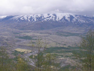
From there we picked up I-5 and ten miles up the freeway exited into Castle Rock to take Route 504 east towards Mt St Helens. On the way we stopped at the visitor centre where we viewed a film of the 1980 eruption and wandered through the museum, The view of Mt St Helens from the visitor centre was obscured by cloud, but we decided to take the 45 mile ride up to the end of the road to the Johnston Ridge Observatory just to enjoy the ride. This was indeed another wonderful road for riding, except for all the tourist traffic that was sometimes slow moving. Additionally, some drivers were not as diligent as Californians in letting you past at turnouts, which could be frustrating at times. As we climbed to the Observatory at over 4200 ft altitude, the temperature dropped from 63 F to 47 F. A number of overlooks along the way offered ever more stunning views of the mountains, and the opportunity for slower drivers to pass us again.

At Johnston Ridge Observatory there was snow on the ground and the upper part of Mt St Helens was cloud covered. The visitor centre had no cafe, much to their loss. We were so cold we would gladly have paid big bucks for a luke-warm cup of mediocre coffee.


We soon turned back, again enjoying the vistas and admiring the engineering that created the road, especially the bridges.

Back at Castle Rock we retraced our route to Longview. It suddenly started raining very heavily as we came down the I-5. It was quite crazy: we were trying to keep up with the traffic which was doing 75 mph. We didn't have the benefit of windscreen wipers, and were unable to see the vehicles in front because of the wall of spray thrown up by their wheels. The rain stopped a few minutes later, as quickly as it started, and again we found ourselves remarkably dry in spite of not wearing wet weather gear. The rain returned when we got to Longview, so we stopped at a shopping centre for coffee, hoping it would pass. Eventually we gave up, and got into our wet weather gear again for the ride to Skamagowa where we planned to stay the night. It was a pretty town, but devoid of motels, so we rode on to the nearest motel west of there that our GPS knew about. This was the eponymously named Sleepy Hollow Motel. It was a long day in the saddle today: 243 miles, but once more, fabulous riding. Part of our pleasure arises because we simply can't get over how beautifully and intensely bright green the grass and trees are. I guess we have the rain to thank for that.

We later had a little drama at our motel. I was working on this blog outside the motel office in the cold because the wireless Internet doesn't reach our room, and Wanda thoughtfully bought me a cup of tea. Unfortunately the door locked behind us and our key was inside. I couldn't contact the office because I needed a phone, and mine was in the room with the keys...

Fortunately Wanda had left the bathroom window open when she had a shower earlier in the day. When she checked the back of the building she found a short ladder, so I was able to climb in the back window. Once inside we looked at each other and simultaneously burst out laughing...

Falling in love with Rowena

More rain was forecast for today, and we got it. Are you finding all this stuff about rain tedious? Well, so is Chris. Wanda does not mind it so much but then she does not have to ride and concentrate on the road. A comment today by a lady we met in a car park about our motorcycling in the bad weather made us realise just how exposed we are. For six months we have no place to call home, nowhere to retreat from the weather. We possess nothing except our motorbike and what we can carry on it, and our only option is to keep riding. It's kind of scary, but it is also incredibly wonderful that we have the opportunity to live like this. We are seeing and experiencing so much (but missing a bit, too). Most people have been curious, friendly, informative, courteous and helpful.

Our plans today were to ride the roads around Mt Hood, south of the Columbia River valley. The clouds were low and rain was falling as we travelled west from The Dalles on Route 30, the historic and incredibly scenic road that is now largely bypassed by I-84. We soon found ourselves riding up an amazing road to the top of the escarpment overlooking the Columbia River at Rowena. This road was engineered in the 1920's when vehicles were less powerful than today, so the road has no gradient greater than 5% and no corner of radius less than 100 ft. The engineers spared no expense to build the greatest scenic road in the world. The beauty of this road is best seen from the Rowena Overlook. The Columbia River also never ceases to amaze.

From Mosier, Route 30 merges with I-84. We got off the freeway at Hood River and stopped in the funky Dog River Cafe for our first hit of caffeine for the day. It works really well as a community centre with old lounge seating at the back, tables and chairs in the middle with Internet access. Both old and young (including children) people chatted and even a friendly, almost human, dog tried to join in. A few local papers were available for everyone to read, everyone except the owners that is, who were furiously working to keep up with the demand.

Low cloud meant that there was little prospect that we would see Mt Hood even if we were standing on it, so as we got back on our bike in the rain we continued west on Route 30 instead of turning south. About 20 miles further west we reached Cascade Locks, the town at the southern end of the Bridge of the Gods that we crossed a couple of days ago. A fascinating stop full of romantic Indian and white man history. A lovely area to visit. We took time to photograph the bridge and inspect the now defunct lock.

Ten miles further on, Route 30 broke away from I-84. Often it was only a stone's throw from I-84, but it was a world apart as the road wound through verdant, mossy forests, especially spectacular in the sun showers. Along the way were 4 major waterfalls. At least one good thing has come from all the rain: the waterfalls are flowing strongly and at their most spectacular.

Further along Route 30 the road again climbed to the top of the escarpment, this time to the beautiful Vista House built in 1918.


By the time Route 30 rejoined I-84 we had reached the outskirts of Portland. We travelled into the city centre and after cruising around for a while, sought out a motel in the downtown area. We went out walking to buy a bottle of wine to have with dinner. We found a liquor store a half a mile away only to be told they don't sell wine - we would have to go to a grocery or convenience store for that. During our walk the city surprised us. If you drive around a block you see tall buildings. It was difficult to find a store. Through the centre of the block however, were walkways lined with trees, a park with a large fountain and a shopping centre. In some places a tram-line went through the centre but no cars. All the flats facing the internal courtyard had this lovely view. Many sets of flats had an enclosed pool at ground level. This has given us a totally different view of Portland. This concept makes the city far more livable than many others.

We ate last night's leftovers in our room before taking in a movie at a nearby cinema. The night city was quiet, clean and glistened after the rain.

Tuesday, May 25, 2010

A day with a bit of everything - varied scenery, varied roads, varied weather...

We left Umatilla under a heavy layer of high cloud, but the threat of rain seemed low, so we didn't wear our wet weather gear. We soon passed through Hermiston on our way to Heppner. Our GPS took us off route 207 (it's set to take the shortest route), and we wound up on Sand Hollow Road, a narrow strip of hot mix that clung tenuously to the side of the steep hills it wound along. At the edge of the bitumen there was no guard rail and no verge – just the drop. If you wandered off the bitumen it would be a long way down before you would stop. This was one road that would not forgive any indiscretion and was really quite scary. The low bushes and grassland meant that you could see where you would be going. There have been no trees except in the odd oasis of a river valley.
We stopped there to fill our bike with petrol and ourselves with coffee before tackling road 206 to Condon, which is a biker's dream – fast in most places, lots of bends, few blind corners, well maintained surface and minimal traffic. At first the bare low rolling hills reminded us of the Monaro plains in Australia, before the landscape changed and we climbed hills and plunged into valleys.

We stopped in Condon to take a walk and stretch our legs, but we only got a few steps from our bike before a couple of locals started talking to us. One of them was the barber, but his shop seemed not to have much patronage. It was full of interesting relics (including two barber's chairs that were over 100 years old) and photos, and he was irrepressible in telling us about them. We saw rattle snake skins, a picture of 160 lb mountain lion and an old book full of local history. We finally got away and back on the road heading for Fossil.

The landscape changed dramatically as we wound down a gorge with cliffs on either side...

From Fossil our next stop was Antelope where we planned to have lunch at the Antelope Cafe. Antelope was a tiny, run down place with several huge poplars, an odd sight when there were no other trees on the surrounding hills. The only cafe is closed on Tuesdays. We decided to continue through endless, rolling wheat fields to Shaniko for lunch. This is an interesting place with lots of old buildings that have an 1800's look and feel. We stopped at the store where we met a bloke who was travelling on a Gold Wing. We talked for a while about where we each had come from and each was going. He had lots of ideas about where we should be going and roads we should be travelling, and was most disappointed when I tried to explain our itinerary didn't have a lot of flexibility. We headed back to the centre of town to find a cafe for lunch. We stopped at the ice cream parlour, as it suddenly turned dark and cold and rain started falling. Fortunately the shop sold coffee and soup and not just ice cream, although they were doing a good trade in the latter in spite of the weather. The place was like a Tardis, small on the outside but quite spacious within. Three friendly folk sat in a time warp near the window, playing cards.

While we were there another rider came in, wearing BMW apparel. We invited him to sit with us but he went to head off. I followed him out to get our GPS and maps to plan the next stage of our trip. He was riding a BMW R1200RT, a few years older than ours. We started talking so I introduced myself. Trevor lives in Vancouver Canada, and also had lots of ideas as to where the best rides were. He suggested that we take Highway 99 from Vancouver to Cache Creek rather than Highway 1 when we get to Canada, an idea we will give some serious thought.

After this the road gradually changed. We gradually descended into valleys with interesting cliff faces although the vegetation was still sparse.

Further along the road we headed down the Tygh Valley into Maupin where (this morning) we thought we would stay the night. It was still reasonably early, so we decided to press on to The Dalles (pronounced “Dalls”). Eight miles short of there, it started drizzling but we decided against getting into our wet weather gear. About 5 miles out, it started raining seriously, but again we decided just to press on. The rain stopped as we got to The Dalles, an oasis on the Columbia River. We quickly found a motel and went inside our room to get a change of clothes and dry what we had been wearing. We were surprised at how dry we had remained – clearly the full fairing and windscreen are very effective in protecting the riders during light showers. We took a walk around town. Wanda found an interesting old Catholic church, now preserved as a community “hall” for weddings and other functions. It still has all of it's paintings and statues. Dinner was Chinese. The serves were so big, we have enough for tomorrow night.

Monday, May 24, 2010

A fine day for motorcycling

The weather forecast for today was for a cloudy day without rain. We rode out of Portland on the I-205 north across the Columbia River and then turned east immediately on highway 14. The first few miles were on a freeway, but this soon shrank to a scenic single lane road. The traffic lessened the further we rode, and we soon pretty much had the road to ourselves. The views over the river were spectacular.
 A bit further down the road we came to the Bridge of the Gods and took it into Oregon just for the experience of crossing it. The road across the bridge has a steel grid road surface (see next photo), through which you can see all the way, way down to the river (!). It is a toll bridge, and we thought we would have to pay a second time when we turned around and rode back, but the lady at the toll booth was really nice and only charged us the one toll - all of 50 cents.


We made our first stop for coffee at the Venus Cafe in Stevenson. here we met Brian, a friendly local, and spent some time chatting to him and his friend who joined us after the first cup. We had a lot in common - he was a scuba diver, and in past years a motorcyclist. He and his friend both knew a lot about Australia from documentaries, and we talked a lot about our respective home countries.

While we were there, we could not help but notice a copper and brass tree sculpture on the wall of the cafe that reminded us of some of Warren Townsend's work.

Ten miles further along highway 14 we reached Lyle, where we stopped for lunch. Another group of bikers arrived soon after. One couple, Mel and Patty, riding a BMW K1200LT came up and introduced themselves. We chatted about our bikes for a while before they headed off with their friends.

From Lyle, we took a scenic road north up the Klickitat River valley to the little town of Klickitat, and then on to Goldendale. Returning back to highway 14 at Maryhill, we stopped briefly at the replica of Stonehenge.

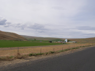
Our itinerary nominally had us staying at Maryhill for the night, but it was only 2:30 when we got there and we were feeling fresh and ready to travel on to get ahead of schedule - especially with fine weather today and rain forecast for tomorrow. The road east from Maryhill was through country unlike anything we have experienced so far in the US. The hills were covered in golden grass and low bushes that looked like the saltbush we have in Australia, and almost completely devoid of trees.

It was almost completely devoid of habitation, too, with two tiny towns and no services for the next 80 miles. The road was in top condition and mostly straight, so we found ourselves travelling at 70 mph most of the way, but it was a boring ride - much like the road from Canberra to Cooma (back in Australia). Plymouth, on the Washington side of the river was just a collection of camp sites, so we crossed the Columbia River back into Oregon to stay overnight in the tired town of Umatilla.

Keeping a hairy upper lip

Once again we woke to find it had been raining in the night. The rain eased before we got underway, but wet weather gear was still the order of the day. We headed north under leaden skies, talking about what good luck we had in landing in Rockaway Beach for the night. It was a wonderful place to stop.

About 25 miles up the coast we detoured into trendy Cannon Beach to see the Haystack Rock for ourselves.

It was a relatively short and quick run from there to Astoria, a seaport at the mouth of the Columbia river. We stopped at a Flea Market in the city centre, and wandered around looking for somewhere to buy coffee. (I don't have a caffeine problem: I have a lack of caffeine problem...)

Astoria appeared to be an ordinary town but if you had the time to look it gave you a few pleasant surprises. The two major landmarks in the city seem to be the Astor column, (fabulously decorated with a mural and with a spiral staircase inside for benefit of the energetic) high on a hill above the city, and the 4.8 mile long bridge (below) that crosses the Columbia River to Washington state. We rode up to the Astor column to take in the views of the city, river, and lush countryside to the southeast, an astounding view. We were not long there when the weather closed in.


Our GPS got rather bamboozled as we descended from the hilltop, and firstly tried to take us down a rode that was closed, then insisted we turn all the way back into Astoria, when the road we wanted (202) was a few hundred metres away in the opposite direction. I trusted to my instincts and found it in spite of the GPS. The road was initially rough and winding, (the odd deer we passed looked stunned at our presence) and in the wet we kept our speed well down. The road was almost completely devoid of traffic in either direction, and we were able to enjoy threading our way through verdant forests.

The road crossed the Nehalem River at least a half a dozen times and rode through Jewell which seemed more of a name on the map than a town. At Birkenfeld we stopped for lunch at the biker-friendly historic store and cafe for lunch. The decor is interesting and natural. While we were there a couple more bikers arrived, and we introduced ourselves to Doug and Tim. They are organising a Poker Run to raise money for charity, and were reconnoitring the route. We learned from them that on a Poker Run, bikers take a route that passes through 5 control points and that they get a playing card at each point. At the end of the ride the biker with the best poker hand wins a prize. We chatted a lot over lunch, enjoyed their company and made two more friends.

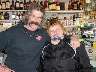
Mike, the proprietor joined in, and we had a lot of laughs - especially when Wanda wanted a photo of him because she liked his flamboyant moustache. Let me just show you where this ended up:
(I couldn't allow Mike to be the only good looking moustached person in the cafe.- Wanda)

The sun came out and we were getting warm, but we cooled off quickly once we got underway. A few miles down the road we passed through the little town of Mist, so named (I reckon) because if you blink on the way through, you've missed it. The road became smoother and faster and under clearing skies we made good time to Scapoose where we joined Highway 30 into Portland, a no frills busy city, where it began raining again. We took a bit of a trip through the city centre before heading out to our motel about 7 miles away.

Most of the roads today were easy riding and with pleasant curves although there was one white car that found itself facing the wrong way, tail up the hill  and off the road, resting in fresh green bushes. Obviously, the road can be a little slippery if you take the bends too quickly.

Somewhere, in the distance, there has been the long sound of a train hooter along with it click clacking on the rails.

Sunday, May 23, 2010

A busy and eventful day

This morning we headed straight into the old town of Florence, to see (and be part of) the big gathering of motorcyclists for Rhody Days. It was pretty quiet when we got there before 9 am. The locals suggested there were two reasons for this - the first was the rain, and the second was that a large contingent of bikers had partied late into the previous night, and were presumably still asleep We hung around for a while until we met a couple of lovely ladies who showed us the program for Rhody Days. Apparently the assembly of bikers is an unofficial event. However, the official "show and shine" display of cars at the Three Rivers Casino was getting underway so we rode over there. With all the wet weather (again), it was more of a "rain and shine" event, but there were some really impressive cars there, including a 1935 Auburn.

We spent some time ogling the many cars before heading back to the old town. It was still rather quiet, so we did another lap of the stalls we visited yesterday. At one, we got talking to Ron Pierron who had a motorcycle mounted on a special trailer rig such that punters could (for a price) try their hand at pulling wheelies in complete safety. It had a rigid mount for the rear axle (about which the bike could pivot and the rear tyre was mounted on a roller that acted as a rolling road. A safety strap at the front prevented the bike from toppling completely over. Check it out at http://www.balancepointent.com/.

We had a late breakfast while waiting for the 5000 bikes we expected to see, then went out and wandered around the main street again. We spent some time chatting to some lovely folks who rode a Harley, and to another group of blokes who had served in the US Air Force and flown to bases around Australia. It was after noon, and there were only about 50 bikes there. We decided not to wait any longer, and just as it started raining again we got on our bike to head out of town.


A few minutes later as we were riding up 101 in the rain, a car came slowly out of a side street on our right. I fully expected the driver to wait for us at the stop sign, but as we got closer he (or she) just kept coming out towards us. When it became apparent he wasn't going to stop, I figured I was likely to hit the side of the car if I braked, so I swerved and somehow got around in front of it, but he didn't miss us by much. I pulled over in shock, and a following driver stopped to check I was alright. I was really angry that I had not been concentrating fully and taken avoidance measures earlier. I was also peeved that on account of the rain I didn't have my helmet mounted camera on to record the event.  We later heard a motorcyclist had been knocked off his bike the previous night in Florence, but we have no further information. We hope he is OK

We continued north up 101 in the rain, but by the time we got to the Seal Cave about 11 miles out of Florence, it was easing to a drizzle. We spent some time there and visited the cave, reached by an elevator that goes 208 ft down through the cliff. The noise of all the Steller seals was really loud, and there was a strong fishy smell to the cave, but it was a great experience.

The entry to the cave was at a point that allows a wonderful view of the Heceta Head lighthouse, claimed to be the most photographed lighthouse in the world. We did our bit to ensure the claim was upheld. The longer we stayed there the more the weather improved, and every successive photo was better than the previous.

By the time we were ready to ride on, the weather had completely changed and the sun was shining brightly in an almost cloudless sky. We were starting to get hot in our wet weather gear, and it was tempting to take it off. A bit further up the road we stopped for lunch at the very pretty town of Yachats. From there we continued to make good time up 101 through the large and not-so-pretty town of Lincoln City. We stopped for a rest in Hebo, and our decision to stay in our wet weather gear was vindicated when it started yet again.

We discussed whether we would go into Astoria for the night (as planned) or stay in a smaller town south of there in the hope of getting cheaper lodgings. We decided to stop at Manzanita Beach, but the only room we found there was way over our budget, so we turned back south 7 miles to Rockaway Beach where there was a greater choice of motels and we found a comfortable and affordable room. When we went to buy pizza or something like that for dinner at the nearby convenience store, we discovered they had freshly cooked crabs, so we yielded to temptation and bought one that weighed nearly 2 lbs to share. It tasted wonderful! We explored the huge, barren beach. Vegetation on the sand dunes is very low. The buildings (many of them to let) looked bleak and alone on the huge sandy beach but the area must be full of life during the summer.

The hills and plants are much smaller in scale in this area, The coast is much more accessible, with a few people line fishing off the rocks or walking on the much lighter, fine and yellowish sand.