Yesterday we left Lebec heading north on Interstate 5, the only road available to us. Despite the howl of the wind in the morning, the day ended up perfect. The rounded hills before us remarkably beautiful as we left this stunning green valley down into the flat farmland. After a few miles we were able to turn off onto a country road heading to Bakersfield. It was a little travelled road through citrus orchards. Before we reached Bakersfield we turned east through Arvin, with blocks of fruit trees and vegetables in rich brown soil and workers in the fields. Some confusion with the GPS and we stumbled on their village, single fronted cottages on narrow barren blocks; no garden, no trees, broken steps, no paint. A correction finally led us to Caliente, where we picked up the Caliente-Bodfish Road. This is a very narrow road overgrown on the edges, cracked asphalt, a double yellow line in the middle all the way. Tight and slow but - wow! It has very little local traffic. It started out climbing steeply through a series of wiggles and steep switchbacks until it reached a plateau, where our speed picked up until we approached Bodfish where we were greeted with a dramatic view over the valley below.

Little did we know that the two snow-capped mountains in the distance was where we would be in a few hours. and the road began its steep descent to Bodfish and Lake Isabella. This was a valley surrounded by rocky mountains and modest dwellings. We stumbled on Nelda's Cafe, a cool, efficient, feminine place, offering friendly advice to check conditions with the local Ranger.
 His immaculate office had a lake and mountain view to die for. We headed up the Kern River Valley (a rapid, rocky river with white water rafting, boys knee deep fishing and designated camp sites - tents only) and into the Southern Unit of the Giant Sequoia National Park. As we climbed higher into the Sierra Nevadas we first caught glimpses of snow capped mountains, and soon after found ourselves riding beside banks of snow at the sides of the road. The sun was warm, the roads reasonably dry. Higher and higher.
 At times we would swing around a corner and be faced with scenery that quite literally took our breath away. One such moment occurred when we first came upon a stand of towering giant rust red sequoias...
By the time we got to Ponderosa we had climbed to 7,250 ft. As the road descended towards Springville it became motorcyclist's heaven, with the road constantly snaking left then right, then left... All of the way down to about 2000 ft our motorcycle was on one edge of the tyre or the other. It was absolutely exhilarating as we fell into the rhythm of the road.
The big BMW handled it all so easily, but I have found the gap between the first three gears just a little wide - especially 2 and 3. The engine doesn't have much power or torque below 3000 rpm and at the speed we were travelling at I found myself shifting up and down a lot between second and third, with first gear necessary at the sharpest bends. We eventually arrived in Springfield where we refuelled the bike and ourselves. It was 4:45 and we were seriously wondering if we would make it to our planned destination of Three Rivers for the night. Our motorcycle guide (and our GPS) pointed us toward a ride through Milo on a country road as being the shortest distance to Three Rivers. When we checked up on road conditions with the Park Rangers at Kernville earlier in the day, we were sternly advised not to take that road which was described as a dirt track. Further inquiries at the cafe in Springville confirmed the road was fine so we took it, wondering whether we would make our destination before nightfall. Again, we found ourselves on a pleasantly winding country road. We managed a good speed along it - so much so we were pleasantly surprised to reach a T junction with a sign indicating our destination was just 16 miles to our right on California 198. It was 6 pm when we arrived at the recommended motel and we were suddenly very tired and saddle sore after covering 229 miles.
Our plan to only ride 200 miles a day was suddenly making good sense - particularly because the notion we would only spend 4 hours a day in the saddle was clearly a fantasy: with average speeds around 35 miles an hour, 200 miles are always going to take 6 hours.
 We descended into Three Rivers, a valley full of the scent of citrus trees, neatly farmed along the slopes. The Best Western Motel offered a river view if you wanted to climb the flood levee, and relaxed surroundings. We ate in the motel's gazebo decorated with a rose garden.

Once again, we found the motel more expensive than we are aiming for, but when you get as tired as we were, the extra bucks don't seem to matter. After dinner, we crashed, too tired for blogging.
This morning we woke up to a much chillier day, with a 20% chance of rain forecast. We set off towards Sequoia National Park. We paid our $20 park entry fee and rode a mile or so up to the visitor centre where we were told it was a 45 minute trip up to the General Sherman tree - claimed to be the largest living thing on this planet. The road there was again a great motorcycle journey as the road climbed higher and higher from switchback to switchback, often with no guard rail, and precipitous drops from right at the edge of the bitumen.
As we got higher we climbed into the clouds where visibility was dramatically cut until we climbed high enough to be above the clouds, where again we found ourselves riding along roads flanked with snow.


From there we planned to go to Kings Canyon, but as we rode further the thickest fog we have ever seen enveloped us. Visibility was literally a few yards and the headlights of oncoming vehicles weren't visible until they were about 20 metres away. The bike windscreen quickly frosted with water droplets, as did my visor. It was all we could do to track along the yellow lines at the centre of the road in first gear and at a snail's pace. I eventually had to open my visor to see anything at all, but before long my glasses also had a frothing of water droplets. My face was freezing, and my eyes watering with the cold air coming in my helmet. Our bike has a temperature gauge that was telling us the air temperature was 35 degrees F (2 degrees Centigrade). I never thought I'd get to test the heated hand grips so soon in our journey.
We eventually reached the Kings Canyon Visitor Centre where we headed straight for the restaurant with the cry of "give us the coffee quick, and no-one gets hurt!". We stopped there for lunch - not caring about it being more expensive than we had budgeted for lunches, or that it was Starbucks coffee. The main thing was the place was warm. While we were waiting for our lunch we looked out the window to see a woodpecker hammering away at a nearby tree.
That was when the hail started falling...

By the time we finished lunch the hail had given way to a steady drizzle. People were either laughing at us or shaking their heads in disbelief as we donned our wet weather gear. I checked with the Park Ranger at the visitor centre. He said visibility at the bottom of Kings Canyon was better than up here at 6400 ft. We thought about the prospect of making a 39 mile trip into the canyon and then another 39 miles back out and thought "Nah!" - no matter how much of a wrap our guide book gave the trip, the prospect of doing it today was overwhelmingly unattractive. We never thought we'd get to test the heated seats so early in our journey.
We turned back to head down towards Fresno. Once more we found ourselves in pea-soup fog, windscreen, visor and glasses all frosted over, tracking the yellow lines. These were fairly faint in places, and non-existent at intersections which made things even hairier. Wherever I could, I pulled over to let cars (with the luxuries of their windscreen wipers and demisters) pass - a courtesy that cars have universally been paying us in better conditions when we are making better speed than they. I must say that Californian drivers have been incredibly courteous to us - so far as we have come.
Suddenly we emerged from below the clouds, and picked up speed. We soon began to dry out, and when we made a stop in bright sunshine as we headed to Yosemite we took off our wet weather gear. That was tempting fate too much, and a few miles up the road at Bass Lake it began raining again. Back into the wet weather gear again. It's surprising how much faster you can don it when you are in the open by the side of the road and it is starting to rain.
When we reached Yosemite Forks we turned to climb up to Yosemite Village where we planned to stay. About then the hail started again - heavily. It was getting quite dark and heading higher into the mountains didn't seem a wise move. We consulted our GPS for places to stay and made a quick decision to turn around and go back 4 miles to the nearest motel in Oakhurst. We looked like drowned rats and did not dare enter the highly polished floor of the entry foyer negotiating our room from the doormat. Once again, it was more expensive than we had been budgeting, but when you're cold and wet - who cares?
We unpacked our gear and went off to dinner at a nearby Chinese restaurant. The clouds had cleared and the sun was shining brightly as it edged towards the horizon, as if the gods were toying with us.
More snow is forecast for Yosemite tonight and possibly tomorrow, so who knows if we will get to see it? We may just have to head back south to pick up Highway 1 up the Big Sur Coast.

Little did we know that the two snow-capped mountains in the distance was where we would be in a few hours. and the road began its steep descent to Bodfish and Lake Isabella. This was a valley surrounded by rocky mountains and modest dwellings. We stumbled on Nelda's Cafe, a cool, efficient, feminine place, offering friendly advice to check conditions with the local Ranger.
 His immaculate office had a lake and mountain view to die for. We headed up the Kern River Valley (a rapid, rocky river with white water rafting, boys knee deep fishing and designated camp sites - tents only) and into the Southern Unit of the Giant Sequoia National Park. As we climbed higher into the Sierra Nevadas we first caught glimpses of snow capped mountains, and soon after found ourselves riding beside banks of snow at the sides of the road. The sun was warm, the roads reasonably dry. Higher and higher.
  At times we would swing around a corner and be faced with scenery that quite literally took our breath away. One such moment occurred when we first came upon a stand of towering giant rust red sequoias...
By the time we got to Ponderosa we had climbed to 7,250 ft. As the road descended towards Springville it became motorcyclist's heaven, with the road constantly snaking left then right, then left... All of the way down to about 2000 ft our motorcycle was on one edge of the tyre or the other. It was absolutely exhilarating as we fell into the rhythm of the road.
The big BMW handled it all so easily, but I have found the gap between the first three gears just a little wide - especially 2 and 3. The engine doesn't have much power or torque below 3000 rpm and at the speed we were travelling at I found myself shifting up and down a lot between second and third, with first gear necessary at the sharpest bends. We eventually arrived in Springfield where we refuelled the bike and ourselves. It was 4:45 and we were seriously wondering if we would make it to our planned destination of Three Rivers for the night. Our motorcycle guide (and our GPS) pointed us toward a ride through Milo on a country road as being the shortest distance to Three Rivers. When we checked up on road conditions with the Park Rangers at Kernville earlier in the day, we were sternly advised not to take that road which was described as a dirt track. Further inquiries at the cafe in Springville confirmed the road was fine so we took it, wondering whether we would make our destination before nightfall. Again, we found ourselves on a pleasantly winding country road. We managed a good speed along it - so much so we were pleasantly surprised to reach a T junction with a sign indicating our destination was just 16 miles to our right on California 198. It was 6 pm when we arrived at the recommended motel and we were suddenly very tired and saddle sore after covering 229 miles.
Our plan to only ride 200 miles a day was suddenly making good sense - particularly because the notion we would only spend 4 hours a day in the saddle was clearly a fantasy: with average speeds around 35 miles an hour, 200 miles are always going to take 6 hours.
 We descended into Three Rivers, a valley full of the scent of citrus trees, neatly farmed along the slopes. The Best Western Motel offered a river view if you wanted to climb the flood levee, and relaxed surroundings. We ate in the motel's gazebo decorated with a rose garden.
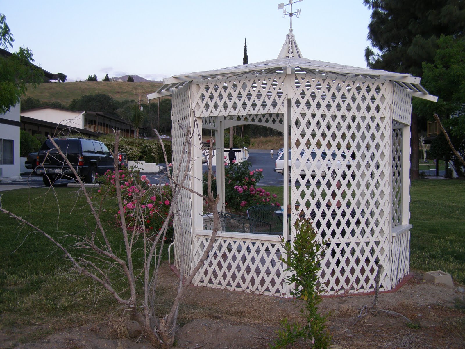
Once again, we found the motel more expensive than we are aiming for, but when you get as tired as we were, the extra bucks don't seem to matter. After dinner, we crashed, too tired for blogging.
This morning we woke up to a much chillier day, with a 20% chance of rain forecast. We set off towards Sequoia National Park. We paid our $20 park entry fee and rode a mile or so up to the visitor centre where we were told it was a 45 minute trip up to the General Sherman tree - claimed to be the largest living thing on this planet. The road there was again a great motorcycle journey as the road climbed higher and higher from switchback to switchback, often with no guard rail, and precipitous drops from right at the edge of the bitumen.
As we got higher we climbed into the clouds where visibility was dramatically cut until we climbed high enough to be above the clouds, where again we found ourselves riding along roads flanked with snow.

We made it to the giant General Sherman sequoia tree in 42 minutes. A short walk from the roadside had us there for the obligatory photo stop.

From there we planned to go to Kings Canyon, but as we rode further the thickest fog we have ever seen enveloped us. Visibility was literally a few yards and the headlights of oncoming vehicles weren't visible until they were about 20 metres away. The bike windscreen quickly frosted with water droplets, as did my visor. It was all we could do to track along the yellow lines at the centre of the road in first gear and at a snail's pace. I eventually had to open my visor to see anything at all, but before long my glasses also had a frothing of water droplets. My face was freezing, and my eyes watering with the cold air coming in my helmet. Our bike has a temperature gauge that was telling us the air temperature was 35 degrees F (2 degrees Centigrade). I never thought I'd get to test the heated hand grips so soon in our journey.
We eventually reached the Kings Canyon Visitor Centre where we headed straight for the restaurant with the cry of "give us the coffee quick, and no-one gets hurt!". We stopped there for lunch - not caring about it being more expensive than we had budgeted for lunches, or that it was Starbucks coffee. The main thing was the place was warm. While we were waiting for our lunch we looked out the window to see a woodpecker hammering away at a nearby tree.
That was when the hail started falling...

By the time we finished lunch the hail had given way to a steady drizzle. People were either laughing at us or shaking their heads in disbelief as we donned our wet weather gear. I checked with the Park Ranger at the visitor centre. He said visibility at the bottom of Kings Canyon was better than up here at 6400 ft. We thought about the prospect of making a 39 mile trip into the canyon and then another 39 miles back out and thought "Nah!" - no matter how much of a wrap our guide book gave the trip, the prospect of doing it today was overwhelmingly unattractive. We never thought we'd get to test the heated seats so early in our journey.
We turned back to head down towards Fresno. Once more we found ourselves in pea-soup fog, windscreen, visor and glasses all frosted over, tracking the yellow lines. These were fairly faint in places, and non-existent at intersections which made things even hairier. Wherever I could, I pulled over to let cars (with the luxuries of their windscreen wipers and demisters) pass - a courtesy that cars have universally been paying us in better conditions when we are making better speed than they. I must say that Californian drivers have been incredibly courteous to us - so far as we have come.
Suddenly we emerged from below the clouds, and picked up speed. We soon began to dry out, and when we made a stop in bright sunshine as we headed to Yosemite we took off our wet weather gear. That was tempting fate too much, and a few miles up the road at Bass Lake it began raining again. Back into the wet weather gear again. It's surprising how much faster you can don it when you are in the open by the side of the road and it is starting to rain.
When we reached Yosemite Forks we turned to climb up to Yosemite Village where we planned to stay. About then the hail started again - heavily. It was getting quite dark and heading higher into the mountains didn't seem a wise move. We consulted our GPS for places to stay and made a quick decision to turn around and go back 4 miles to the nearest motel in Oakhurst. We looked like drowned rats and did not dare enter the highly polished floor of the entry foyer negotiating our room from the doormat. Once again, it was more expensive than we had been budgeting, but when you're cold and wet - who cares?
We unpacked our gear and went off to dinner at a nearby Chinese restaurant. The clouds had cleared and the sun was shining brightly as it edged towards the horizon, as if the gods were toying with us.
More snow is forecast for Yosemite tonight and possibly tomorrow, so who knows if we will get to see it? We may just have to head back south to pick up Highway 1 up the Big Sur Coast.

No comments:
Post a Comment